Several of the visitors to the lake, have marveled at how the level has gone up in just two or three days of pre-monsoon showers. The reason of course is that the rain has been heavy this year and more because, for the first time, some of the surface run off from the Brigade Millennium road is getting diverted into the lake through the new conduit. The story doesn’t end here.
Visitors would have seen the enormous iron frame that was getting assembled on the ground between the security cabin and the gazebo. Thick iron rods have been placed over the frame to make a cow-catcher-like grill. This grill will replace the concrete slabs below the Brigade Millennium arch. Each of the slabs has two or three holes which do not permit much of the rain water to enter the trench below. Hence, rain water all these days was washing down the road like a stream. Now the grill will accept most, if not all, the surface water, and channel it into the lake. Consequently, the level at the lake will increase several times while preventing wastage of precious rain water.

Heavy duty grill
The grill is heavy duty in order to withstand the flow of traffic on this road. It is likely to be kept in place below the BM arch over the next few days. The process of digging out the slabs and replacing them with the grill will take a while and cause traffic snarls. Please bear with the inconvenience.
Anticipating a substantial increase in the water level, we had wanted to plant a level marker but didn’t get round to it, mostly because the lake bed does not have a uniform depth. The deepest place is between the island and the viewing deck. In fact, after the recent cleaning, there are pockets elsewhere which are at least 10 feet deep already. These pockets were those dug by the JCB during deweeding. The highest portion of the lake is the stretch along the coconut grove side towards the wetland. In the two photographs below, one can see that the water is slowly inching forward, encircling the island. Use this as an indicator to see how much water has entered the lake since you last visited the lake.
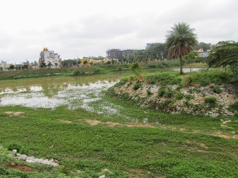

Water around the island is an indicator of water rise
The drizzle this evening will increase the level by another few notches. More importantly, it will help the 300-odd shrubs planted by our volunteers over this weekend! 🙂


2nd June 2013, Evening drizzle